 GeoData.NZ
GNSS RECEIVER
Type of resources
Topics
Keywords
Contact for the resource
Provided by
Years
Update frequencies
status
-
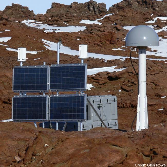
The network collects Global Navigation Satellite System (GNSS) data for the purposes of monitoring the New Zealand Geodetic Datum 2000 (NZGD2000), updating the national deformation model, and maintaining New Zealand’s relationship to the International Terrestrial Reference Frame (ITRF). Antarctic GNSS data form part of the New Zealand campaign GNSS (Global Navigation Satellite System) surveys. Data have been collected by periodic campaign style GNSS surveys. High accuracy continuous Global Positioning System tracking stations in Antarctica: - Scott Base (SCTB - LINZ Geodetic Code) and was operational as of 29 October 2004. - Butcher Ridge (BURI- LINZ Geodetic Code) on 7 December 2007. - Minna Bluff (MIN0- LINZ Geodetic Code) on 31 January 2007. - Cape Roberts (ROB4- LINZ Geodetic Code) on 29 November 2005. Data are available in Receiver Independent Exchange Format (RINEX) files at 30 or 15 seconds sampling rate. GET DATA: https://www.geodesy.linz.govt.nz/positionz/?page=text GET DATA: https://www.linz.govt.nz/products-services/geodetic/positionz/positionz-real-time-service
-
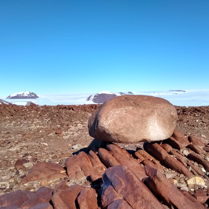
Cosmogenic surface exposure chronologies were used to quantitatively constrain past rates of ice thinning, and the absolute timing of ice discharge and thinning events. We sampled glacial erratics and bedrock from Byrd Glacier (LW1 Nunatak, LW2 Nunatak, Lonewolf Nuntataks, Tiger Nunatak, Mt. Tadpole). Samples were analysed for their exposure history, and all sites contained glacial erratics. In particular, the Lonewolf Nunataks sites, which is located along the margin of the East Antarctic Ice Sheet revealed a plethora of glacial cobbles. Details of laboratory procedures can be found in the related publication. RELATED PUBLICATION: https://doi.org/10.1002/esp.5701 GET DATA: https://version2.ice-d.org/antarctica/publication/1139/